


MyTransit NYC Subway & Bus MTA
4.68.90K Reviews
App Specs
- Version
- 3.16.16
- Updated On
- License
- Free
- Downloads
- 1,000,000+
- Developer
- MyTransit™
- Categories
- Maps & Navigation
- Platform
- Android
Screenshots
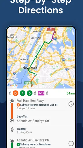
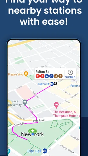
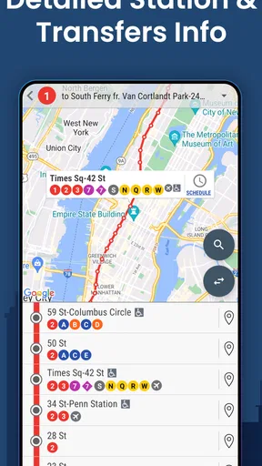
 Analysis by AppCompare
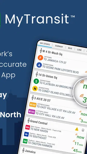
New York transit becomes much easier to manage when one app keeps the subway, bus, Long Island Rail Road, and Metro-North information in the same place. That is the main reason I found MyTransit NYC Subway & Bus MTA useful: it is focused on turning a complicated trip into a quick check of maps and schedules, rather than asking me to jump between separate tools.
MyTransit™ develops this free Maps & Navigation app for people moving around New York City and the wider transit network. It is rated for Everyone, works on devices running Android 6.0 or later, and has reached over a million installs. Its current version is 3.16.16, while optional in-app purchases range from under a dollar to several dollars per item.
I would not describe it as a complete replacement for every navigation service. Its value is narrower and more practical: it puts New York transit maps and timing information at the center of the trip. If that is what you need most, the focused design can be more convenient than a general-purpose map app.
A transit-first view of New York
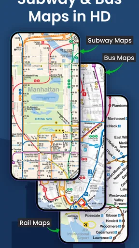
The app’s defining capability is its coverage of several transport systems that are easy to treat as separate worlds. Subway and bus information matters for daily movement inside the city, while LIRR and Metro-North schedules matter when a trip crosses into the surrounding region. Having those options together changes how I think about a journey: instead of starting with a street address and hoping the right transit layer appears, I can begin with the network I actually intend to use.
That distinction is important for visitors and regular riders alike. A general map application is usually strongest when I want walking directions from one precise doorway to another. MyTransit is more useful when the question is, “Which line, route, or rail service should I check before I leave?” The app’s emphasis makes the transit system feel like the primary subject rather than an extra layer on a street map.
The 4.6 average from roughly thirty-six thousand ratings suggests that this focused approach works well for a substantial number of users. I also noticed that the app has accumulated around eight thousand nine hundred written reviews, which gives it a more established feel than a small experimental transit utility. Those figures do not guarantee that every rider will like its presentation, but they do indicate that it has been used widely enough to become familiar to many New York travelers.
Why combined coverage matters
New York trips often involve a decision between services rather than a single obvious route. A subway ride may be convenient for one part of the journey, a bus may solve the final stretch, and a rail option may make more sense for a longer trip outside the city. The benefit of having these systems represented together is not just saving a few taps. It encourages better comparisons before I commit to a route.
Worth Reading Before You Choose

EA SPORTS FC Mobile 26 Is a Bigger Football Game, but It Takes Time

Flipboard Shows What News Apps Must Do Beyond the Feed

Switching to Android Auto Means Rethinking Your Driving Routine

Google Calendar Makes a Crowded Week Easier to Manage

Ludo King Makes the Most of the Minutes Between Plans

Baby Panda World Brings Quick Play to Modern Phones, but Its Game Library Feels Busy
For example, when I am planning a trip that begins near a subway station but ends closer to a regional rail stop, I can consider the entire transit picture instead of treating the rail portion as a separate research task. That is one of the app’s less obvious strengths: it supports planning by transport system, not only planning by destination.
The maps are also valuable when I already know the general direction but need to understand the structure of the network. A street map can show where I am, yet it may not make the relationship between lines, stops, and transfer points feel clear. A dedicated transit view gives me a better chance of spotting the shape of the journey before I start walking.
How I use it before leaving
My preferred workflow is to check the network first, then verify the timing information, and only afterward decide how much walking I am comfortable with. This order prevents a common mistake: choosing a route because it looks short on a map without noticing that it depends on an inconvenient transfer or a less suitable service.
I also find it helpful to look at the map before entering a station. Underground, it is easy to lose orientation, especially when several entrances or lines are close together. A quick review above ground gives me a mental picture of the route and reduces the chance that I will follow the first entrance I see without considering whether it serves the direction I need.
For buses, I treat the app as a planning aid rather than a promise that every minute will unfold perfectly. Surface traffic can change the experience in ways a timetable cannot fully capture. I use the displayed information to decide whether waiting is sensible, but I keep a subway alternative in mind when the appointment is important.
A realistic trip where it earns its place
Imagine leaving work in Manhattan for an evening destination in Queens, then continuing later toward a regional rail connection. With a general map app, I might receive a route that is technically valid but difficult to compare with other transit choices. In MyTransit, I can begin by checking the subway and bus network, then consider whether the longer rail portion should influence my starting route.
The practical advantage is preparation. I can identify the line I need, inspect the relevant map, and check the timing before walking to the station. If the first option involves too many changes, I can compare it with a route that takes longer on paper but feels easier to follow. That is a meaningful difference for someone carrying luggage, traveling with children, or arriving in an unfamiliar part of the city.
On a normal weekday commute, the benefit is even simpler. I can open the app with a specific question: should I take the bus from the nearby avenue, walk to the subway, or consider a different rail service? The answer may not always be the fastest possible route, but seeing the choices together helps me make a decision based on comfort and reliability, not just distance.
Where the focused design helps most
I think the app is especially useful for three kinds of riders. The first is a visitor who needs to understand New York’s transit structure without learning every line in advance. The second is a commuter who repeatedly travels through the same corridors but occasionally needs a different bus, subway, LIRR, or Metro-North option. The third is a planner handling a multi-part journey where the transition between city transit and regional rail matters.
It is also helpful for people who prefer visual confirmation. Some riders are comfortable following a list of turn-by-turn instructions, while others want to see the line and station relationship. MyTransit favors the second group. I can use the map to confirm that a suggested route makes sense geographically instead of accepting a sequence of instructions blindly.
That said, the same focus can feel limiting if my main need is walking navigation. If I am exploring a neighborhood, searching for a business, or trying to compare driving, cycling, walking, and transit in one broad interface, a larger map platform may be more convenient. MyTransit makes the most sense when transit is the central problem to solve.
Timing information and the need for judgment
Schedule information is most useful when I treat it as a planning window. I check it before leaving, allow room for the walk to the station or stop, and avoid building an important appointment around the narrowest possible connection. This is particularly important for buses, where road conditions can affect the practical experience even when the listed schedule looks straightforward.
For a subway trip, the map may be the more valuable part of the decision when I already know that services can vary during the day. I use the timing display to decide when to start, but I use the network view to understand the consequences if I miss the preferred train. In other words, the app is strongest when its schedule and map functions work together: one tells me when to look, and the other helps me understand what I am looking at.
For LIRR and Metro-North journeys, I would be more deliberate about checking the complete plan before setting out. Regional rail trips can be less forgiving if I miss a departure, so I would not rely on a last-second glance alone. I would review the route, allow time to reach the station, and keep the return trip in mind rather than treating the app as a single outbound lookup.
The tradeoff between focus and completeness
The app’s biggest strength is also its main tradeoff. Because it concentrates on New York transit, it feels more relevant than a generic navigation tool when I am checking subway, bus, or regional rail information. But that concentration means I should not expect it to replace every service I use around a journey. I may still want another map for detailed pedestrian directions or for locating a business entrance.
I also would not use any transit app as my only plan for a time-critical trip. A timetable can help me choose a departure, but it cannot remove delays, crowded platforms, service changes, or the time needed to find the correct station entrance. MyTransit improves preparation; it does not make the network predictable.
The optional purchases are another consideration. The app itself is free, which makes it easy to try without committing money at the start. However, the presence of in-app items means I would pay attention to which parts of the experience require an additional purchase before assuming every convenience is included. For a casual visitor, the free experience may be enough; a frequent rider may decide that an optional item is worthwhile only after using the basic app for a while.
Older-device support is a practical advantage for people who keep an aging phone, since the app runs from Android 6.0 onward. Still, performance and interface comfort can vary on older hardware. I would make sure the device has enough battery before a long trip, especially when using maps repeatedly while moving between stations and street level.
Small habits that make it more useful
- Check the map before walking to the station. This helps me choose the entrance and direction with more confidence instead of correcting myself underground.
- Compare transport types before choosing the first route. A bus may reduce walking, while a subway route may be easier to predict; the right choice depends on the trip, not just the displayed distance.
- Plan the return journey separately. A route that works in the afternoon may be less convenient later, particularly when a regional rail connection is involved.
- Use timing as a buffer-based decision. I leave room for walking, finding platforms, and normal uncertainty rather than aiming for a connection that works only if everything is immediate.
These habits reveal a useful distinction: the app is not merely a place to look up a line. It can become a lightweight planning routine. Checking the network before leaving, confirming the timing, and keeping an alternative in mind makes the information more actionable than a single glance at a route result.
Who should choose it, and who should skip it
I would recommend MyTransit to anyone whose travel is centered on New York’s subway and bus network, especially if LIRR or Metro-North may also enter the plan. It is a sensible choice for visitors who want a transit-specific reference, commuters who want a quick network check, and riders who prefer maps over purely verbal directions.
I would be less likely to recommend it as the only navigation app for someone who mainly walks, drives, cycles, or searches for places. Those users may get more value from an all-purpose map service that combines location search, walking guidance, and several travel modes in one continuous experience. MyTransit is not the right tool simply because a trip happens to take place in New York; it is the right tool when the transit network is the part causing uncertainty.
People who dislike checking schedules or interpreting transit maps may also find the focused approach less comfortable than an app that gives highly guided, step-by-step directions. MyTransit rewards a little participation. I need to look at the line, understand the transfer, and decide whether the plan suits me. For me, that is a positive because it leaves me better prepared, but it may feel like extra work to someone who wants the app to make every decision automatically.
My final take after using it
MyTransit™ has a clear purpose and stays close to it. Its combination of NYC subway, bus, LIRR, and Metro-North maps and times makes it more useful than a generic map when I am trying to understand how New York’s transit choices fit together. The app is free, broadly established, and accessible to a wide range of Android users, while its Everyone rating makes it suitable for general household use.
I like it most as a preparation tool. Before a commute or a complicated day out, I can use it to compare transport options, understand the network, and avoid starting the trip with only a vague idea of where I am going. I would still leave room for real-world delays and use another navigation option when I need detailed walking or place-finding help.
My honest recommendation is to try it if transit is the heart of your New York travel. It will not remove every uncertainty from the MTA experience, but it can make the important decisions clearer: which system to consider, where the route fits on the map, and how early I should start. For a visitor or commuter who wants that focused view, this is a practical companion rather than unnecessary duplication.
Pros
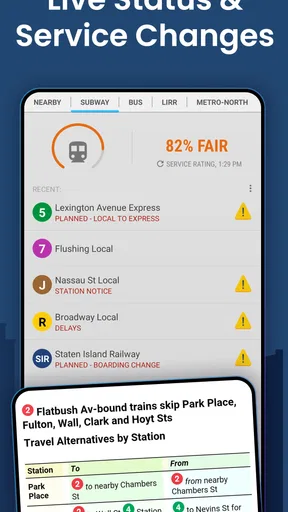
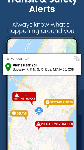
- Real-time MTA alerts help you react quickly to delays and service changes.
- Covers subway
- bus
- and nearby transit options across New York City.
- Route planning supports transfers between different MTA services.
- Station information can make unfamiliar trips easier to navigate.
- Useful maps and schedules are available in a compact mobile interface.
Cons
- Some real-time updates may lag behind conditions on the street.
- The interface can feel crowded for first-time users.
- Features may depend on an active internet or data connection.
- Estimated arrival times are not always perfectly accurate.
- Frequent notifications may become overwhelming without careful settings.
FAQs for MyTransit NYC Subway & Bus MTA
What is MyTransit NYC Subway & Bus MTA used for?
MyTransit NYC Subway & Bus MTA is designed to help passengers navigate New York City’s public transportation system. It typically provides subway and bus maps, route planning, station information, service updates, and schedules in one place. It can be useful for daily commuters, tourists, and anyone who needs to compare travel options before starting a trip.
Does MyTransit NYC Subway & Bus MTA work offline?
Some map and network information may remain available without an internet connection, but features such as live arrival times, current service alerts, trip planning, and real-time vehicle locations generally require mobile data or Wi-Fi. Before traveling, it is a good idea to open the relevant map or route while connected, especially if you expect weak reception underground.
Can the app provide real-time MTA subway and bus information?
The app may display real-time arrivals, delays, disruptions, and service notices when the necessary MTA data is available. However, live information can occasionally be delayed, incomplete, or affected by changes in the official transit feeds. For important journeys, compare the app’s guidance with announcements in stations and official MTA updates.
Does MyTransit NYC Subway & Bus MTA support both subway and bus routes?
Yes, the app is intended to cover both New York City subway and bus transportation, making it possible to review routes that combine different services. Depending on the version and available data, you may be able to search by station, stop, destination, or line. Route suggestions should still be checked for accessibility needs and temporary closures.
Is MyTransit NYC Subway & Bus MTA free to download and use?
The application may be available as a free download, although certain versions can include advertising, optional purchases, or premium features. The exact pricing and available tools can vary between Android and iOS and may change after updates. Check the store listing before installing to confirm permissions, subscriptions, supported devices, and any in-app charges.


